


The Adventures of Avalon (An Intracoastal Waterway Trek, 2013)
- Oct 15, 2021
- 65 min read
Updated: Mar 5
The original online journal of my journey from North Myrtle Beach to the Florida Keys along the Intracoastal Waterway was recollected on my blogspot blog, The Adventures of Avalon, during the trek. However, th blogs posts go from latest to oldest. I wanted to post the experience as it happened, from first post to last post, so I flipped the posts around.
Friday, March 15, 2013
I took a plane to Wilmington, NC, today and began a journey south that will, Lord willing, end in The Bahamas in early or mid April. For now my uncle and I are living on his 46-foot yacht, Avalon, in the Barefoot Marina in North Myrtle Beach, SC. In about a week we will begin cruising south along the Intracoastal Waterway that is now right outside the back door of the boat.
Learning boat talk has been the biggest challenge for me for now. The difference between the bow and stern, port and starboard are simple enough, but don't ask me what means what beyond that. Uncle Ken is giving me a crash course in boating that is more difficult than most college courses I took. Some of it has sunk in, but experience will be the most trying teacher.

Saturday, March 16, 2013
Some things have happened. While living on this boat, I am also doing all I can to continue coordinating with the team of Rambling Spirit magazine, which is really a story for another time. I am also trying to squeeze in preparations for my trip to Rio de Janiero for World Youth Day in July, but that as well will have to take a back seat for now. For now priority number one is being my uncle's crew on Avalon.
Internet connection is, well, low quality and inconvenient -- but it'll have to do. I'm connected through my phone's mobile hotspot and can only open a tab at a time, but that's all I need. Sometimes I think I left things behind at home at the wrong time, especially as I recall the many loose ends I left back home that I'm now trying to tie up electronically. Many distractions involving doubt, regret and worry often keep me from focusing on my role on Uncle Ken's boat, but the time to embrace a great opportunity is never just right, and you'll always find yourself making other sacrifices in the process. If you think too much about the sacrifices, the opportunity slips you by. That's what I had in mind when I decided to come aboard Avalon.
The boat voyage to The Bahamas will be amazing, and everything else I plan to do at this time of my life will happen. If you want to live life to the fullest, you just have to make it happen.
"If men weighed the hazards of the sea, none would embark." - Juana Ines de la Cruz

Sunday, March 17, 2013
Well, the weekend is over and I'm getting used to the routine of living on a boat, so I can now set some time aside to catch up with some other items on my list. Those loose ends, or untied lines, that have been making my head sway, are starting to finally reach a calm on this peaceful waterway.
I'm learning a lot about boats, things that will probably prove useful for the rest of my life. But life is still life, and this isn't all a vacation. We work on Avalon a good number of hours each day as we prepare her for our voyage to The Bahamas. In the meantime this marina in North Myrtle Beach is her safe haven, as it is mine. I just hope I don't get too comfortable as we will be leaving in no more than two weeks.
Monday, March 18, 2013
I'm well into my first week on Avalon, and I've learned how to do some simple tasks like fill up the fresh water tanks, lower the anchor, drop lines off the boat, and work the breaker -- which we use quite often to conserve energy. Uncle Ken and I went food shopping in the beginning of the week, and we're spending more time fixing things and checking things on the boat, and less time on the beach and in the resort towns around us like land lovers do (who am I kidding, I still am one!)
I'm still learning things about life on a boat, and I now see that there is more than a lifetime of things to learn. I can only accumulate so much of what my uncle teaches me. I never knew that stepping on a boat is like stepping into a foreign country, with a foreign language, laws and all.
Getting used to a new lifestyle can take some time. Everything down here is how I'd hoped it would be. I just don't have my home conveniences, but that's how I wanted it. I wanted a change in lifestyle. In this setting I refuse to worry. Hopefully, if all goes as planned, two months on the ocean will give me a broader perspective of things, and make all my worries go away for good.
Thursday, March 21, 2013
Well, the best way to learn is through experience and immersion. Today was quite a productive day on the boat in that regard. We fixed and filled the hydraulic pump and mounted the water pump in a tight crevice down in the engine room, a.k.a. the dungeon. Then we continued cleaning the transom door that used to be filled with water due to a crack in the sealant. We also cleaned up the fly bridge, and tied lines around the boat to get ready for departure. If all goes as planned, on Friday we'll be taking the boat to Grande Dunes about five miles down the waterway just as a test run.
Little by little I'm getting a feel for things, and Uncle Ken has just enough work for us to do each day. I'm starting to like this lifestyle. Of course, my uncle has also thrown in quite a few perks and bonuses here and there. Today he let me drive his BMW, and we ate lunch at Buffalo Wild Wings. I write this entry at night with great contentment and a reasonable, healthy weariness. I have to remind myself not to get too comfortable because the hazards of the sea still await us. The journey south will come with its own charms, but life won't be as easy based on what I've heard.
How does one begin writing about a new life? I know I won't be living on this boat forever, and I even have to admit that much of the baggage from my old life has been carried over into this one. But that's besides the point. I sense things about my very being, or at least my perception of such things, beginning to change.
Today was another productive day. We fixed go the kitchen table, which Uncle Ken called "the most dangerous thing on this boat" since it was wobbling like crazy, then we sealed up the transom door, and we made sure everything worked well with the anchor.
We also saw Oz, the Great and Powerful. Talk about stories that awaken the imagination. To go into all of the ways that movie inspired me would take me too far away from the subject of this blog, so let's just say it added to the fresh perspective on life that this trip is giving me. That's really all I have today. The rest you'll have to imagine up yourself.
Friday, March 22, 2013
Uncle Ken said he's been waiting for this day for four months. We finally got the boat in good enough condition to take her out on a test run. Not that it wasn't in sufficient condition all along. It's just as most experienced captains know; a boat is hardly ever in perfect shape, and if you putter around making sure everything is just right just because you have the time (or because you're looking for an excuse not to take her out), you'll find yourself never venturing out of the harbor.
So I spent the morning getting one last thing out of the way -- sending out my freelance writing voucher for the month -- and after that my uncle and I prepared Avalon for her longest trip in over 20 years, down to Grande Dunes -- a wealthy development surrounded by a high class golf course. Want to know how wealthy the people who live there are? They have their own bridge over the Intracoastal Waterway:

Boating past this development, at first I felt like I was somewhere between the Southwest and Arabia. Well, geographically, I guess you can say I was, but the South has little if any connection to Southwestern or Arabian architecture; and that's what baffled me about these houses. They seemed to meld the two styles seamlessly. The smooth facades, elaborate outdoor staircases and open plazas resembled the mosque-like structures of Arabia; and the adobe colors, especially the red tile roofs, resembled Southwest homes. You can even say the arches around the buildings suggested some Roman villa influence.
But then I noticed the authentic southern plantation architecture of the homes: long porches, a plethora of flora, balconies, an abundance of windows. And all of this was just from observing the back of the homes, the view from the waterway. It was an eclectic style for sure, but the homes were anchored in a very subtle Southern influence. It was a very unique style displayed on this northern edge of the subtropics.

Sunday, March 24, 2013
The weekend has been rainy or cloudy, but we still decided to make the best of it. There's a time to work, a time to play, and a time to just relax. Choppy waters and rain aren't the best conditions for boating, but it's all just fine if your boat has a TV, because then you could just watch the Planet Earth BBC documentary on Blue-ray.
Our work the past few rainy days has consisted mainly of plotting our course through South Carolina and Georgia with the Intracoastal Waterway guidebook and Active Captain, a free website that provides a NOAA map for boaters.


Alabama Theater, right down the road at Barefoot Landing. It has variety shows, plays and good wholesome family entertainment. We won't be going there, but it's still cool to have it nearby.

The House of Blues, across the parking lot from Alabama Theater, looks like an abandoned warehouse from far away, but apparently it's a hub for lovers of the Blues. The building was featured in the movie The Blues Brothers. About a week ago, the line to get in twisted around the entire building.

So the next week in these parts will be pleasant, as we prepare for departure.
Monday, March 25, 2013
Stay on the Intracoastal Waterway sounds like easy enough direction. That is until you take a look at the nautical charts of this waterway, which meanders through shallow marshes, crosses massive sounds and has rock piles and shoals all along its banks. On the other hand, the ICW is the most popular way to cruise up and down the East Coast. So how hard could it be? Well, Uncle Ken and I say better safe than sorry. The most difficult part of plotting our route is the fact that every guide we use seems to offer different information, and only after careful study do we notice how they all work in sync. Dozier's Waterway Guide, Open CPN, and Active Captain are the three guides we're using now, pre-departure. Once we're ready to leave we'll also use our GPS, sonar, radar, and Spot system, which allows people to track our journey via email. But for now all we have are charts and written descriptions of our route, which could paint the wrong picture if you're not careful.
After debating whether we should take Avalon out for another test run, we decided the winds, gusting over 35 mph, were too strong today. So we drove down to Georgetown, SC instead to get a real-life visual of our first stop. It was about an hour drive, and about 50 nautical miles on the ICW. The small town has a narrow but manageable inlet off the Sampit River, which is very broad and wide. Driving over the river I felt a sense of motivation thinking that we'll be navigating that majestic body of water in just a few days.

From Georgetown, our next stop would be Charleston, SC, a distance of about 56 miles taking the inside route of the ICW. From Charleston we'd follow the Stono River to the Wadmalaw River, and from there we'll pick up the Coosaw River, and eventually end up in Beufort, SC, which may be our anchorage on our third day out.
These details may not mean much to you, but sharing them with you is like sharing a revelation because it took Uncle Ken and I hours to find our way through the ICW maze on the charts we're following.

A picture of the nautical chart of Charleston, SC. Photo courtesy of www.nauticalcharts.com
We're still searching for a good anchorage for our fourth day. Maybe Brunswick, GA, 130 miles? We'll keep you posted. Much of it depends on the weather. If it's fair, we could be going out on the ocean for the entire length of Georgia. Yeah buddy!
Tuesday, March 26, 2013
We took the boat out for about three hours today, and are just about ready to head south. The winds were about 10 to 15 mph, not too strong to go out and just strong enough to give me some experience steering in the wind. We also practiced turning the boat around and got familiar with her response time. The weather was cold, in the 40s, and on top of the wind the three hour test run was quite exhausting.
So it's been unseasonably cold down here since the day I got here. They're saying the warm weather won't come until April. But that's okay because we'll be far south of here by then.
Wednesday, March 27, 2013
Finding a place to anchor after Beufort, SC could really be difficult. We were looking at anchoring off of Thunderbolt, about 43 miles from Beufort, but we'd like to go further than 43 miles that day. We could be wasting a good amount of daylight if we stop in Thunderbolt, GA. But the next port city, Brunswick, GA, is 130 miles from Beufort, which is definitely too far to go in one day.
Our only other option is to anchor somewhere in the Georgia marshes between Thunderbolt and Brunswick. Uncle Ken and I spent a few more hours looking for a good anchorage between those two points, found a few that may be good and then just concluded the best way to find out is to see what the spots are like when we get there. And that was the end of that.
We were going to go out for another test run today, but it was once again too windy, with wind gusts up to 21 mph. So we did some errands, and then went to a Bass Pro shop to find line for our fishing rods, and get some pointers from the experienced fishermen there. We'll be fishing for wahoo and mahi mahi.
You may be thinking, when will you be leaving already? Well, preparing for such a long voyage takes some time. But we will definitely be leaving some time next week. Only last-minute provisions are left.
Thursday, March 28, 2013
So our designated day of departure is Tuesday, April 2. If the weather is fair, we could be traveling on the ocean all the way from Charleston, SC to Jacksonville, FL. We're now making final provisions; we went big-time grocery shopping today and tomorrow we'll fill up the fuel tanks. Today was an errand day, and it had to be, but it's a bit of a shame because the weather so beautiful, would have been the perfect day to take the boat out. But now we're stocked and just about ready to go.
Friday, March 29, 2013
We filled up the four fuel tanks today and then worked on the engine a little. Everything needs to be in tip top condition before leaving. Things have been pushed back a little, but we should still be leaving some time next week.
Staying on a boat doesn't mean vacation. I certainly have had my time to relax, and will have more time to do so once we reach the Bahamas, but this new adventure has come with its share of work. On the other hand, it's different kind of work. It doesn't involve sitting at a computer all day writing mundane local news stories. Working in the engine room, learning how to steer the yacht, fixing things here and there on the boat, making last minute provisions before we leave, these are all a welcomed change in lifestyle.
So it seems like whenever we set a date of departure we just tend to jinx things. From now on we'll just play it by ear. When we do leave though, I'm now hearing that we'll be riding on the ocean for the majority of the route, at least to Jacksonville, if the weather is good enough. I've been studying the ICW routes for weeks now, only to find out that that route is just the backup plan. But then again, considering how the weather has been, rainy and windy, there's at least a 50 percent chance that we'll be taking the waterway most of the way down to Florida. Also note that if we do take the ocean route we'll be cruising through the night since apparently there's no place to anchor in the ocean. Yeah buddy! Gitterdone, skipper!
Saturday, March 30, 2013
The Exuma Cays are perhaps the most isolated islands in The Bahamas, and that's our final destination. The water between the islands is only a few fathoms deep at their deepest, and filled with tropical fish. Thinking about the place makes the wait worthwhile. Yes, we're getting anxious to leave already, especially with all the unseasonably cool weather, wind and rain here in SC, but taking a boat down the coast isn't the same as flying or driving down it. It's much more involved.
While living on the boat, every now and then I get a little cabin fever and decide to take a walk. The beach and resorts are starting to fill up with Spring Break vacationers from the Northeast, and many Southerners are taking their weekend trips here. I can tell just by their southern draw that they're from around here. I think I'm starting to acquire bits of the dialect. Lemey tell ya su'en. Muddy river water and sweet sweet tea is all the good living I need. I've always loved country music, and down here it's like I'm right in the middle of that culture. As I was walking past the House of Blues this evening, a cover band singing Carrie Underwood reminded me of that reality. Yeah, I know, she's kind of borderline pop, but still. You know what I mean. So shut yow mouth, y'all. I can get used to this, even though we are leaving the area soon. Be sure of it. I'd love to stay here, but I also want to boat down the coast to The Bahamas.Oh well, you can't have your cake and eat it too. Pardon the cliche.
Sunday, March 31, 2013
Some people said they want pictures of where we've been, but we haven't left port yet, so all I can give are pictures of Barefoot Marina and the area around it.

Here's a picture of Barefoot Golf Course and some homes along the Intracoastal Waterway. Barefoot Golf Course has a scenic walk along the waterway surrounded by Southern Pine forests, wide open vistas and posh homes and condos.
Like I said in an earlier post, I'm just enjoying North Myrtle Beach for the time being. Easter Mass at Our Lady Star of the Sea was packed with vacationers and "C and E" Catholics, but that only made it a more lively experience. Everyone was friendly and in a singing mood. I don't know if it's just because I'm here during a holiday season, or if people around here, including the vacationers, are always just goodhearted. It is a resort town, and you're not going to be in a bad mood if you're in a place with so much always going on. In the Northeast, it seems like people are always just angry. Cursing is almost a colloquial part of the NJ dialect. Here it definitely is not that way. Southerners are almost always worry-free and offering a smile. I know it sounds cliche, but it's true. You'd have to live in the Northeast all your life and never really come down South to really notice it.
Monday, April 1, 2013
The question "When are you leaving?" can be taken the wrong way. It's not like the person asking wants you to leave. They're usually just excited about the adventure you're about to embark on. But Captain Ken and I have received the question so many times that we're beginning to wonder why people are so curious. Well, for the record, every time we even entertain the thought of leaving port, something new pops up that causes a delay. It's never anything alarming. We just want to make sure the boat is in the best condition possible before heading out, because you never know what could happen on the long, isolated parts of the waterway or in the open ocean.
Something interesting happened in the marina today. For the first time that anyone we talked to knows about, two dolphins came into the waterway right by the marina, right outside our boat actually.

So life in the marina has its comforts and a few surprises every now and then. When we embark the comforts will be fewer for quite a while, but I'm sure there will be many more surprises.
Tuesday, April 2, 2013
We've heard from several people who've lived here a while that this has been the coldest Spring for North Myrtle Beach for as long as they can remember. That's not a reason to complain though because I'm from New Jersey, and the weather is still better than there. We're watching the weather each day, because our route depends on it. If it's clear and calm, we'll go down the coast via the ocean route. If the weather is at all unstable though, we'll take the Intracoastal Waterway.
The word is that The Bahamas is having unseasonably cold and windy weather too. But it can only stay that way for so long, right? Let's hope so. The last thing we'd want is to get there to find out that Bimini Harbor, our designated arrival point in The Bahamas, is too windy to get into.
So another day of working around the boat and watching cormorants dive for fish on the waterway is nothing to complain about. Aside from that, we also met a few relatives, Don and Jan, for lunch today at Wild Wings Cafe. Seeing them was an encounter with Southern hospitality and also some down-to-earth familiarity, probably because Jan is also from New Jersey. In fact, not too surprisingly, I'm probably seeing more New Jersey license plates here than any other license plate except SC. It's like New Jerseyans are going viral.
As we continue to get ready for departure, I'm finding it more and more difficult to find interesting things to blog about. Both Captain Ken and I expected to be half way down the coast by now. So if you're wondering when we're going to leave already, we feel your frustration. A common belief for boaters is that a boat is never really in good enough condition to leave for a long voyage, and when the captain finally does decide to leave port it's only because he's let go of his anxiety for the things he didn't get to take care of yet. We've about reached that point. Another successful day fixing little things around the boat is proof of that.
Wednesday, April 3, 2013
Slowly but surely I'm becoming more familiar with the ways of the sea, maritime culture and the part that culture plays in the story of all of us. Much of this is because I have a living encyclopedia for an uncle in Captain Ken. In our cold and windy Barefoot Marina, he's told me stories made at sea -- some he was a part of, others that have made history. Either way, slowly those stories are becoming a new part of me.
Perhaps many already know the influence the imperial British Navy has had on a variety of popular expressions of our day, for example. Being a part of the naval fleet for an empire upon which the sun never set, British sailors had it tough and were out at sea for months on end. Oftentimes they were enlisted against their will, especially when the fleets were short of crewmen. The British Navy would enlist young men and force them into the robust life of a sailor, but did promise to give them "three square meals a day", which referred to the table on which they ate, which had horizontal and vertical dividers that formed squares for each table setting to keep plates from sliding off the table when the boat was riding on the water. The table I write on within Captain Ken's yacht has a similar lip all along the edges that serve the same purpose.
Many of the British sailors had wives that they had to leave behind when the navy took them in. The ships went from port to port, but the sailors were carefully watched whenever their ships came to dock because many of the sailors were looking to escape at any chance they got. When they did come back to port, they couldn't be gone for long, and if the port they were at was their hometown they couldn't leave the ship at all. Many sailors made the argument that they just want to see their wives, which the navy thought was reasonable. So married sailors were allowed to invite their wives on the ship when docked at their home port. But conjugal visits were not allowed in the common quarters for sailors. So when a sailor and wife had their conjugal visit on the ship they'd stay on the gun deck between two cannons and cover the area over with a blanket. Thus, the child they'd have nine months later would be called a "son of a gun".
Every morning the sailors had to get up bright and early, and before they could even have the first of their three square meals, they had to shine the decks. The commander of the ship would thus wake up his crew shouting, "Rise and shine".
Nowadays, living on a boat is considered a luxury. My, how times have changed! I've spent a little under three weeks learning about the worry-free, hospitably lifestyle of the yachtees who live in the marina with us. Every weekend they invite their friends out to the boat, play some music and drink some wine on Saturday night, and then cook up some eggs and bacon on the dock on Sunday morning. We just received three bottles of wine from our neighbor this evening, just as a friendly gesture he gave it. After another day of working on the boat, it was a very welcomed gift. Keep living well, yachtsmen, keep living well.
Friday, April 5, 2013
More and more boaters are heading back north after their winter journeys southward down the ICW, and in the meantime we're still experiencing winter-like weather for South Carolina here at Barefoot Marina. The past few days have been exceptionally cold, rainy and windy, not good conditions for boating, but a few venturous captains chose to brave the choppy waters anyway. Others chose to tie up at the nearest marina and wait out the stormy weather.
Today, while it was unseasonably cold, in the 40s, it was rather calm and dry -- so all the boaters who waited the storms out were found coming back up the waterway. The Barefoot Landing Bridge right upstream from us opened at least five times today already, which is probably the most times since I've been here. Watching the boats go by has become a hobby of ours, an occasion to take a short break from whatever work we're doing. Each boat is unique and tells its own story, and they're not all yachtsmen and sports boaters. Occasionally we see a tug boat go by, or a commercial fisherman. It's always neat to see their hailing port painted on their stern; unlike the standard license plate it's always painted with aesthetic character. The commercial fishing boats and tug boats are always a welcomed sight from our standpoint, not only because of the rarity but also because they know how to slow down and don't rock our boat by speeding through the no wake zone around us.
Spring breakers are plenty around here at this time too. When Captain Ken first came here a few months ago he said he didn't see the need for a three lane highway for North Kings Highway. Now whenever we drive somewhere there's traffic at every stop light. But who can blame them for coming here for their vacation? There are attractions at just about every corner. That's just fine though. Our marina is still just like a peaceful neighborhood with a river in the back yard, so why do I care how many tourists come here? After all, I am one too.
Thursday, April 11, 2013
We left at about 7 a.m. this morning with the sunrise behind us, navigated through some early fog and had mostly clear skies all the way down to our Day 1 anchorage spot, Minim Creek, about 60 miles down the Intracoastal Waterway from Barefoot Marina. So, we’re finally underway. Minim Creek is a very secluded area with the only sign of civilization being the flashing red marker on the ICW about a half mile away. The creek is the ideal spot to drop anchor off the waterway. The area we’re in is protected from the winds by trees on both sides, and the depth is about ten feet. While we were looking for just the right spot to end our day, a pod of dolphins swam around our boat. One actually came right next to the bow as we were getting ready to drop anchor. While en route to our destination, about 20 miles from Barefoot Marina, we saw two swans swim right by the boat and then come together to touch beaks, their necks and beaks thereby forming the shape of a heart. It was a sight for our weary eyes as we were just starting to really wake up. The wind was at between 15 to 20 knots for most of the way, but around Georgetown, SC the ocean's current increased our speed by about 2 knots, bringing us up to 10 at times when we only set the throttle at 8 knots. So we cruised about 60 miles in approximately 7 hours, arriving at Minim Creek at 2 p.m. It’s been a long day and we’re running on generator power, so I have to log off now. Keep following our travels. We feel as if you’re cruising with us. Tomorrow's destination is Charleston, about 50 miles away. The distance is shorter than today's but the weather is expected to be a bit stormy tomorrow, so that will probably slow us down a bit.


Friday, April 12, 2013
A thunderstorm passed through last night and the sky was overcast most of the day, with winds gusting up to 30 knots. The weather made us hesitate leaving Minim Creek, but we took the risk and headed for Charleston at about 11 a.m. When we left we had the whole waterway to ourselves for miles, that is if you don’t count the pelicans and cormorants flying around our boat, and the dolphins swimming all around us. There were dolphins everywhere today due to our closer vicinity to ocean inlets. We saw at least a dozen on the waterway, and never got tired of seeing them.
With perpetual high winds we passed the small fishing village of McClelanville, another small seaside village called Andersonville and the Isle of Palms, a resort island between the waterway and the ocean.
Towards the end of the day we arrived at Charleston Harbor. Even though it seemed easy to navigate on the charts we studied, it actually wound up being the most difficult part of the trip so far. The vastness of the harbor is immediately misleading, because there are sandbars to the right as soon as you enter from the north. Also, the ICW markers on the harbor are few and far between, and they're mixed in with quite a few other markers indicating a route out to the ocean. The current and high winds from the ocean also add to this obstacle course to Charleston. Barges coming in and out of the international port just add to the challenge. One did in fact pass right in front of us as we crossed the harbor.
We got to our destination, Charleston City Marina, at a reasonable time, about 6:30 p.m. The marina has everything we need, so although we may not have the remote quietness we had last night, we are enjoying many more conveniences, like shore power and bathroom facilities. If you want to know how the rich live, just take a stroll down the mega dock of this marina, where all kinds of mega yachts are docked. The pleasure boats make 46-foot Avalon look like a humble dinghy. Dolphins seem to like it here too. In fact I just saw another inside the marina.
I've always heard that Charleston, SC is among the most beautiful cities in the country. The so called "Holy City" with church steeples dominating its skyline seemed to call out from across the harbor as soon as our naked eyes could see it through the grey sky. We will have a pleasant short stay here tomorrow and will leave for Beufort/Port Royal late tomorrow morning.
Saturday, April 13, 2013
The route today was filled with southern plantation homes and docks along the waterway and wide open rivers, as well as some narrow creeks and man made cutoffs. We're now anchored at Upper Rock Creek, about 45 miles down the ICW from Charleston. Like Minim Creek, it's a very remote spot with nothing but marsh all around us. The view of the night sky is majestic, and could even compare to the northern lights they said appeared over New Jersey this evening.
The water around us is between nine to 12 feet, and the marshy shore is about 100 feet away on either side. We were going to go up the creek to deeper water, but the low tide revealed a sandbar that was too large to risk navigating past. After settling in, another dolphin passed right by our boat, and later a small boat with about five people on it passed from up the creek. That seems to be a common sight around here, as are the dolphins.
Being in the middle of nowhere doesn't mean we can't have modern conveniences though. For dinner Captain Ken cooked up pasta with meat sauce, and we watched Raiders of the Lost Arc with power from the generator. We have the peace and quiet of camping with the creature comforts of our own home.
Tomorrow we will cruise past Beufort and Port Royal, SC before crossing the Georgia border. We don't know exactly where we'll anchor or when we'll settle in because another storm is forecast for the evening tomorrow. The idea is to be settled in well before that.
Sunday, April 14, 2013
We started cruising at 7:40 a.m. today and went about 85 miles on the ICW from Upper Rock Creek, SC to Possum Point, GA, just outside Vernon View. It was raining about half of the day, towards the late afternoon, and we anchored at about 5 pm just before it started to thunderstorm. Possum Point is a peaceful anchorage with Vernon View, a suburb of Savannah, on the eastern shore.
We passed Parris Island and Hilton Head, SC in the afternoon. The islands are fairly close to each other, but are complete opposites, and have no association with Paris Hilton, as far as I know. Parris Island, as many know, is the recruiting center for the U.S. Marines, and Hilton Head is a wealthy resort area with world renown golf courses, like Spanish Wells and Harbour Town, and celebrities. My dad trained as a Marine at Parris Island, and as we passed the island Uncle Ken told me stories about visiting him there, and other stories about the harshness of platoon leaders in the 1960s. The island seems drenched with hard times, and has its own potent character that stands out in the middle of the otherwise placid, historically hospitable South Carolina Low Country region.
After passing the Georgia border, we soon encountered a barge while crossing the Savannah River. It looked like we were on a collision course with it, so we turned around quickly to give it room to pass us, then continued to cross the river. It was fascinating to see the barge up so close, but frightening when considering the danger of being so close to such a large vessel on such a big river.
We've passed several quaint towns like McClelanville, Andersonville and Beufort, SC, as well as Isle of Hope and Vernon View, GA. We stopped at Charleston a few days ago as well. The city marina of this southern gem, the Holy City, was the only marina we've stayed at so far.
Monday, April 15, 2013
Today's leg of our journey took us through perhaps the two toughest parts of the ICW, Hell Gate and Jekyll Creek, Georgia. After leaving last night's anchorage on the Vernon River, we luckily reached Hell Gate at high tide. The small cut links two huge sounds right by the ocean, and the water is only five feet deep in places. To avoid the shoaling on either side of the narrow cut, you have to zigzag and squeeze between several markers while staying at a relatively low speed, since a boat draws less water when going slow. At the same time though, you have to maintain a fast enough speed to fight the currents. After we passed through with some difficulty, we noticed how appropriately named Hell Gate was.
We then safely passed through most of the major sounds of Georgia, including St. Catherines Sound, Sepolo Sound, Altamaha Sound, Saint Simons, and Jekyll Sound. Before Jekyll Sound though, we came to sneaky little Jekyll Creek at low tide. the water was never deeper than 13 feet, and the creek itself was never wider than probably 100 feet as we navigated down it.
Just before Saint Simons Sound, two dolphins came and swam beside our boat. We've been trying to get good pictures of at least a few dolphins, but this close and long encounter gave us the chance to take a video. If I don't post it today I will tomorrow.
We found a beautiful anchorage across the Jekyll Sound, called Umbrella Creek. It's surrounded by vast expanses of marshland and has the ocean just off in the distance; serene seclusion.
So in all today we cruised from 8:15 am to 6 pm, covering about 85 miles. Tomorrow we'll be entering Florida, which is about 30 miles away. At this rate we should be in Miami in about five days. From there we will cross over to The Bahamas as soon the weather permits.
Here are some photos from the past few days. All are by Captain Ken except the pelican.


Tuesday, April 16, 2013
Today had a number of memorable sights ranging from wild horses to top secret Navy vessels. After exiting our anchorage at Umbrella Creek, we came into St. Andrew Sound, a wide open body of water that peaks out into the ocean. Traversing the sound was the closest we've gotten to actually going out on the ocean on our trip so far. The five miles or so of the sound had a modest chop, which was manageable but tough enough to indicate that it wouldn't be wise to go out on the ocean today.
After St. Andrew Sound, we approached Cumberland Island National Seashore, home to loggerhead sea turtles, hogs, armadillos and horses. Rumor has it that generations ago, when the caretaker of the horses died, she specified in her will that her horses be allowed to freely roam on 9,800 acres of government-protected wilderness on the island.

As usual, but still not to be taken for granted, pods of dolphins swam all around our boat today, especially up the St. Johns River to Jacksonville, where we're now docked. As I promised, here's the video of a few of the bottle nose dolphins riding our port side waves.
Perhaps the most startling sight of our trip so far came in Kings Bay, Georgia, near the Kings Bay Naval Submarine Base. As we passed the base, a Navy security patrol rode beside us carefully monitoring our movement. I thought his concern was a little over the top, that is until we saw what was coming ahead of us just peaking out over the top of the water: a Trident submarine, a boomer, headed right toward us. They hailed us on the radio and told us to move out of the channel and stay 500 yards away from the sub.
I don't know how often these giants come through the waterway, but every boat we heard on our radio seemed to be like sitting ducks, clueless as to what they should do, as the boomer approached them.
After passing Kings Bay and Cumberland Sound, we crossed the Florida-Georgia Line and approached Fernandina Beach. The city has what look and smell like wood pulp factories on either side, but despite this heavy industry the quaint city in between boasts a beautiful marina and downtown.
We went about 10 miles up the St. Johns River to dock in Jacksonville, since it offered a much wider and better selection of marinas. We're now docked at Arlington Marina just north of the city, with downtown Jacksonville in sight and just a few miles from our starboard stern. It was a short ride today in very pleasant, sunny weather with some wind, but not as bad as the first few days of our journey.
Check out our route to The Bahamas by clicking here.

You all travel with us. May the road rise up to meet you too!
Friday, April 19, 2013
The state of Florida is beautiful, especially the coast. That's why so many people live here. That's also why they have so many restrictions on the waterway. There are no wake zones within no wake zones. There are private communities that create their own waterways off of the ICW, which are perfect places to anchor, but transients aren't allowed to anchor there, and the ICW needs dredging in numerous places. Today we often encountered five feet of water under our boat, which draws about three feet and ten inches.
Despite these obstacles though, we traveled 95 miles today, the farthest we've traveled yet in one day. We passed Daytona Beach and Cape Canaveral, but couldn't catch a glimpse of the speedway and only saw the NASA assembly building from a far off distance. Our departure point today was a small creek called Factory Creek that we got lucky finding right beside a Sea Ray factory in between St. Augustine and Palm Coast. Tomorrow we should reach Palm Shores and the next day we should come to Palm Beach. A few days back we passed Isle of Palms. Getting these towns mixed up has been common for us.
While anchored in Factory Creek we had no Internet signal from our phone's hotspots, which was strange because it was in the middle of suburban area. We left that anchorage at sunrise and cruised down the waterway to about five or ten miles south of Cocoa, which is historically the birthplace of surfing in the U.S. That kind of follows a trend because we also passed the birthplaces of auto racing in Daytona Beach, and of the U.S. space program in Cape Canaveral, and yesterday we passed the first city established in the U.S. when passing St. Augustine.
It was tough finding an anchorage tonight because our route ended on the Indian River, which is long and wide and has just about no tributaries or creeks running off it. We're now anchored on the east side of the mile-wide river, about 200 yards from the shore, where peacocks have been screaming all evening. It's not annoying though. We've encountered plenty of terns, pelicans and cormorants, and even a few ospreys, egrets, and blue herons, but this is the first encounter we've had with peacocks on the trip.
Sunday, April 21, 2013
The water is getting bluer and it’s getting hotter as we cruise down Florida’s Gold Coast, where waterfront houses try to outdo each other in size and luxury. After a while, after passing through Jupiter and Palm Beach, and by the time we reached Boca Raton, we got tired of saying ‘Wow, look at that house!’ because we knew five minutes later we’d be saying ‘Man, look at that house that’s even bigger.’
The over-the-top sleek yachts in this area are called things like ‘Sexy’ and the party boats treat the ICW like a main street. Half the bridges are too low for 18-foot tall Avalon to pass under, a paddle boarders, water skiers, kayakers, and sunbathers on little boats have little concern for the speeding jet skies and sporting boats that zip by them.
It really is a different world down here, and it’s only going to get crazier when we reach Fort Lauderdale and then Miami tomorrow. I can’t even anticipate what it’s going to be like. But then again, every day seems to present new surprises, new scenery, and new challenges. Every night our anchorage has a completely different theme to it. Yesterday, we anchored right on the south side of a bridge in Stuart, and tonight we’re parked in Lake Boca Raton with pastel-colored condominiums, resorts and modern mansions all around us. When we came into the lake at about 5:15 pm it was packed, then the weekend boaters slowly left.
Now we practically have the entire lake to ourselves with the city all around us. So we started at 8:15 am today, cruised for nine hours through congested waterways, and ended our day after covering about 60 miles. The small wake zones, boat traffic and bridges slowed us down significantly.
Here are some photos from recent days.


Monday, April 22, 2013
It’s a good thing we didn’t let the torrential downpour in Boca Raton keep us from moving south this morning, because if we did we then wouldn’t be relaxing in a cove off Virginia Key with Miami as a backdrop. I almost want to say we have arrived, but this is just another check point. We’ll wait here in Miami until the ocean is calm enough to cross over to the Bahamas. If it doesn’t look like a window to cross over is coming any time soon, we’ll head down to the Florida Keys instead, which isn’t too shabby of a Plan B if you ask me.
On the Gold Coast, just about every five miles there's a low bridge we had to signal or wait for before they would open. Many of the bridge tenders were easy going, accommodating people who were happy to open the bridge for us. Some of them even had a sense of humor. We heard their interactions with other boaters around us through our radio. In northern Florida there was a troller ahead of us who wasn’t sure if he could make it under one bridge, and he asked the bridge tender his opinion. The bridge tender just told him to come up closer, adding ‘I don’t mind opening the bridge if you think you can’t make it. I get paid to open and close the bridge. So just come on up and we’ll have a closer look.’
He wound up making it through okay.
In Fort Lauderdale, the bridge hailing was so commonplace that the people calling the bridges seemed to create a culture of their own with the bridge tenders. You'd think the city would be more accommodating to boaters and build bridges higher so more boats can pass underneath, considering that the city is known as the Yachting Capital of the World.
Just about every minute we’d hear people requesting the next bridge’s next scheduled opening, while bridge tenders told boaters to ‘stay clear of the fenders’ near the bridge. They won’t open, even if they’re scheduled to, unless a boat is approaching, of course. But sometimes the bridge tenders will give boaters the benefit of the doubt and prepare to open even if the captain that called them isn’t in sight. “This is Atlantic Avenue Bridge, getting ready to open for a requesting vessel,” we heard a bridge tender say on the radio. ‘I don’t see you, but that doesn’t mean you’re not out there somewhere.’
The short conversations on the radio give us two lone stars a bit of extra company along the waterway that sometimes never seems to end. But once we hit Miami we ran into a little bit of bad company. It was nothing extreme really, but it was a little frustrating when we came to the Venetian Blvd. West Bridge just a few minutes past its scheduled opening at 1:30 pm, and they refused to stay open for an extra two minutes for us. We had to circle around the bridge for a half hour for its next scheduled opening. All is well, though. We were making good time. By 2:30 we found our anchorage in Virginia Key.
Once we were settled in we went for a swim. The light blue water seemed to wash away the long days of meandering through marshes, enduring long straightaways, choppy sounds, and congested city canals along the ICW. Yes, I know it was only about a 10 day voyage, but jumping in that water was as refreshing as seeing the ocean for the first time.


Tuesday, April 23, 2013
We’ve been listening to the reports on ocean conditions, and they say as of now the waves out there are about 10 feet. That’s not what we were hoping for. After spending the day in an anchorage off Virginia Key, we’re now planning to hop over to Dinner Key and pick up a mooring there, where ideally we’ll wait for the conditions to be right to cross over to the Bahamas. If the ocean doesn’t show us favor any time soon though, we’ll head down to the Florida Keys instead.
In the meantime, here at Virginia Key, the greatest portion of my day today was spent learning how to row Captain Ken’s dinghy to and from the shore a few hundred yards away. It was a windy day, which made it a little more difficult. After hours of struggle, getting pushed back to shore by the waves and having the rows consistently fall out of their slots, Captain Ken came out to help. a few hours later, I had another go at it and finally managed to get the dinghy going forward. Do I get a sailor’s badge or something? No, just a little more self-assurance. I have a history of learning simple things the hard way.
Even as I was struggling to get off shore with the dinghy though, I could have counted my blessings because not too far from me there was a sailboat that ran aground and was in worse shape than me. It was there when we got here yesterday and stayed aground until this evening when a motor boat helped pull it out.

So here we are just off the coast of Miami waiting for the hazards of the sea to wane, and the sailboat was a reminder of how unforgiving even the calmest waters can be. Every day continues to bring new experiences. Sometimes I think of the life I left behind in New Jersey; I’m starting to miss my friends and family. I had a pretty comfortable, secure lifestyle and steady work before I left. Everything was going smoothly. But that’s exactly what bothered me. I felt like it would all be torn from my grasp against my will, and then I’d have no idea what to do. That’s why the moment I feel too attached to something, whether it be a lifestyle or a TV show, I let it go for a while. When I come back to it, I then see it anew and appreciate it more. Every time we make a decision that could be life changing, there are things that we have to let go of. Sometimes they come back to us, sometimes they’re lost forever. Either way though, we’re a better person for it because we took a chance and expanded our hopes of what our lives could be.
Thursday, April 25, 2013
There’s a book on the Bahamas from the early 1990’s sitting on the boat. Nautical charts showing the way to little secluded islands, or cays, have teased me for months; they seemed so close yet so far away. Now, as we deal with a “sour season” for crossing over to the Bahamas, the islands seem to be drifting farther and farther. The 10-foot waves reported on the ocean have subsided to two to four feet, occasionally five to eight feet, but there’s still an east-northeast wind clashing with the south-flowing Gulf Stream, which makes for some really treacherous waters. It’s pretty common knowledge to most boaters to never set out to the Bahamas whenever there’s any kind of wind from the north.
I can’t get around the feeling of slight disappointment, should we not get the chance to go to the Bahamas. Over the past few days I’ve been looking for ways to stay positive, despite these eminent change of plans. So here's what I've gathered so far. The Florida Keys have some nice isolated isles of their own, and some really good spots for diving and snorkeling. The keys could offer everything I hoped to experience in the Bahamas. And, the keys are easier as well as cheaper to get to, considering the $300 customs fee boaters have to pay to get access to the islands of the Bahamas.
For all practical reasons, the Florida Keys are the best place for us to go right now. They’re saying it’s not a good idea to cross the Gulf Stream for at least another week. Part of me does still want to abandon all reason though, take the risk and dare the unforgiving sea. Captain Ken discourages that foolhardy notion. We could wait for a week or even more to see if the north wind changes direction, but why do that when we could be enjoying ourselves in the keys instead?
A picture over the sink in the galley has a quote on it reading, “If you’re not living on the edge, you’re taking up space." In one of my first blog posts of this voyage I played with a similar adventurous spirit quoting Spanish poet and religious sister Juana Ines de la Cruz, who said "If men weighed the hazards of the sea, none would embark.’ These proverbial sayings now sound more like wishful thoughts than practical words of wisdom. In a more luck-driven world, everything would go as planned. But as things are in real life, it’s not good to keep high expectations when you’re dependent on Mother Nature and Father Time.
We've spent the past couple days in the Dinner Key mooring field just off of Coconut Grove, and a few miles southwest of our last anchorage off Virginia Key. This is the first time we've picked up a mooring ball on this voyage, and it proved to be a challenge. After circling around it about five times trying to pick it up, and struggling to keep it from under the boat, we managed to tie the mooring to the stern. But, it has to be at the bow, so we took the dinghy out to untie and retie lines until we gradually got the mooring to the front of the boat.
We've been taking a boat shuttle back to land to get our land legs back for a while. Tomorrow we will get our provisions and Saturday we plan to head south for the Florida Keys, ideally John Pennekamp Coral Reef State Park, off Key Largo.
Saturday, April 27, 2013
We spent about four days in Miami and then headed south to Key Largo, about 50 miles away. After filling up with gas,we took Hawk Channel, which is the outside route to the Florida Keys right along the ocean. The waves were a bit too high and frequent for my stomach’s liking, and....well, let’s just say the side of the boat became my good friend. By the evening though, I had practically forgotten about my seasickness, and was able to enjoy the 30-pound grouper that Captain Ken caught off the boat stern while I was driving the boat. It gave us a reason to put together the gas grill he bought. The following hour or so was spent filleting the fish. Then we nibbled on the fish fillets and “medallions” after we sprinkled them with salt and pepper. It was a five-star dinner on the open ocean, and we didn’t even have to pay a cruise ship fare. The meat should last us at least a few more meals.


So today was the first time I tasted grouper fresh from the ocean, and yesterday was the first time I saw a manatee, the cow of the sea. The sea mammal seemed to pop out of nowhere as we walked off the dinghy dock at Dinner Key Marina. It was cute and ugly at the same time, not to mention huge. Legend has it that weary sailors mistook these beasts for mermaids after months at sea.

Apparently many manatees have been run over by boaters, so there are designated manatee zones all along the Florida coast.
So today we're anchored between Rodriguez Key and Key Largo. Our destination for tomorrow will be Marathon, where we will spend a few days.
Along our route today, we passed Cape Florida on Key Biscayne and Stiltsville, an abandoned but preserved community of houses built several miles off the coast of Miami.


Sunday, April 28, 2013
The wind has been relentless over the past few days, about 20 knots on average. It has made for some really choppy seas, about four-foot waves, and tiresome traveling on the ocean. After experiencing the last two days on the open sea, not going to the Bahamas makes more sense. The waves going out there would have been at least five feet, and they'd be clashing with the Gulf Stream. Not to mention, they're calling for isolated thunderstorms for the next week. And on top of that, there's a chance we'd get stuck in the Bahamas waiting for fair weather to return.
On our way from Key Largo to Marathon today, everything from the chairs to the entertainment system were tossed around the boat. If we weren’t struggling to steer the boat with the waves, we were busy strapping things down better. Naturally, I once again got seasick. It was only a four or five hour trip from Key Largo to Marathon, but it was probably the toughest day of travel yet. We decided we’ll be taking the inside route on the way back.
Right now we’re tied to a mooring in Boot Key Harbor. A few courteous boaters on a dinghy back to their boat helped us pick up the mooring by taking the first line and tying it on for us. Once we were settled in we took a long nap since we hadn’t gotten much sleep the past three nights due to the excessive wind in Dinner Key mooring field and our Key Largo anchorage.
So as enjoyable as the voyage is, it still comes with its challenges. Another challenge is keeping in mind all the new terminology that comes with living on a boat. Here’s a list of nautical terms I had to learn while at sea.
Left – Portside Right – Starboard Front of boat – Bow Back of boat – Stern Side of boat - Beam Steering wheel – Helm Map – Chart Rope – Line Shallow water – Skinny water Island – Key or cay Sinking – Taking on water Filling up water tanks – Taking on water Overturned - Capsized Yacht – Pleasure vessel MPH – Knots (or close to it) Miles – Statute miles Miles as measured on the sea – Nautical miles ( about 1.2 miles) Kitchen – Galley Oven/stove – Range Window – Hatch Bedroom – Cabin Anchor – Windlass Toilet – Head Groceries – Provisions The plan is to stay in Boot Harbor for a few days. It will be a much-needed rest considering the past few days.
Tuesday, April 30, 2013
For the past few days we’ve been in a mooring field off Boot Key in Marathon Shores. The island has the Atlantic Ocean on one side and Florida Bay, which is basically the Gulf of Mexico, on the other side. Today we walked the distance from one side to the other, about a half mile, on our way to get some lunch at Keys Fisheries. All our amenities are at Marathon City Marina, but the boat is at least a half mile from the actual marina so it’s a pretty far dinghy ride to get there.
We plan to stay here for the week, and perhaps take some day trips out to some nearby coral reefs for some snorkeling and scuba diving.
The more we talk to others the more word we hear about how crazy it would be to go to the Bahamas any time soon. On our way down to the keys, we heard on the VHS radio coast guard station that three boats capsized on their way to the Bahamas. That could have been us if we decided to go east across the Gulf Stream in these kinds of winds, which have continued to be around 20 knots. We got thrown around pretty bad on the boat just going south via Hawk Channel.
Be that as it may, I keep hearing people say “the boat can take more than you can”. That’s understandable, considering I got green in the face from just four-foot waves while the boat seemed to just be in its element. It was made for stuff like that. As the expression goes, ‘Harbors are safe place for ships, but ships weren’t made for harbors.’ So the other side of me will always say, heck if Avalon could have made it to the Bahamas so could have I; even if I would have been spending half the voyage with my head hanging over the side of the boat.
Those who do plan to go to the Bahamas, even the most experienced captains here, are waiting about a month for the conditions to be right. Unfortunately we don’t have that kind of time. I need to be back for business reasons, and the boat needs to be north of Florida by June for insurance reasons since that’s when hurricane season starts. By the time we wait for the weather to be right, there just won’t be enough time to make a trip to the Bahamas worthwhile.
So, here we are in the Florida Keys, taking in the benefits of our Plan B. The culture here is very laid back and everything is on “island time”. Captain Ken said the other day that we had a lot of work to do on the boat, and by the time we finished we had worked for about an hour. Down here you can be sure that a man’s word is nothing more than that, and I mean that in a good way. The most stressful day down here would be equivalent to an office party in my life up north. So, I thank God for this chance to enjoy a two-month sabbatical. I hope my friends, family and colleagues back home don't get too jealous.


Thursday, May 2, 2013
Well, we’ve been hanging out in the Marathon Marina mooring field for a few days and plan to stay here for the rest of the week. Captain Ken bought a new dinghy today, so we spent the day getting that straightened out, picking the dinghy up at the marina, getting it towed back to the boat, putting a motor on it, then riding it back to shore to get lunch with a buddy boater we met along our way. We walked to Keys Fisheries to eat there again, and just towards the end of our meal it started pouring…. and I mean pouring, wind howling, lakes forming around us. We were stuck in the partially-covered restaurant for about two hours and eventually decided to take a taxi back. We then waited at the marina for the rain to stop and headed back to the boat. The forecast calls for rain the next two days. I’m just thankful we’re in a safe harbor. Last night a storm that could have flooded Central Park came through too. Captain Ken keeps talking about day trips out on the dinghy, but considering the perpetual eminence of storms like those of last night and today I’d be just as content inside the boat with all the hatches locked. Let the crazies take on those unforgiving waters. Once upon a time I might have said bring on those five-foot waves of treachery, but it seems the fine edges of the salt crystals in the water have weathered my spirit down to a more prudent mariner -- if I could yet claim to be one at all.
Friday, May 3, 2013
Exploring the creeks along Marathon’s islands in the dinghy, as we did today, will be a fond memory of mine for a long time. The islands here are very narrow, like most of the Florida Keys, so I didn’t expect there to be many navigable waters all around us as we went back and forth from the boat to the marina. Sisters Creek, for example, goes all the way from the harbor to the ocean, where it provides access to a beach. A very small island within a half-mile of the beach is accessible by dinghy as well. Needless to say, that’s where we went. We circumnavigated, but finding no place to come ashore we headed back. It was no more than a half hour to get back to the boat.
Our buddy boater, Michael, headed for Key West today since the weather was fair. We would have gone with him if we hadn’t paid for a week here already. We’re in no rush apparently. If we headed for Key West Monday, we’d still have more than a week to continue exploring and enjoying the keys.
Saturday, May 4, 2013
Captain Ken promoted me to “captain of the dinghy’ today, and I take the responsibility with honor. Aside from the days we’re docked at a marina, the dinghy is our main means of transportation to and from shore. Steering the little vessel in recent weather proved to be a bit tricky and wet with all of the wind and waves, but I managed. Apparently though, others didn’t fare as well. The big rain a few days ago flooded areas, and a nearby restaurant wound up pumping 40,000 gallons of water out of their parking lot. The sea waves rose to seven feet and even in the harbor the winds got up to 20 knots today. In Key West, a sailboat was struck by lightning, shorting out all of its electronics. But life on the sea is great! Really.
The coolest part about today was riding the dinghy to Bordine’s for lunch. Sure, the fish quesadilla was great, but I found the novelty of going to lunch by boat to be the best part. So I wasn’t being sarcastic. Living on the water is great.
Tuesday, May 7, 2013
From Marathon we traveled about fifty miles southwest to an island where iguanas and roosters roam the streets and cruise ships come to dock every day. Key West, the Southernmost City in the continental United States, with all its tourism and hoo rah, welcomed us with fair weather and good fortune. The five hour ride down from Marathon was smooth as can be. Also, after days of struggling with the dinghy motor off Boot Key, it started up right away this morning as if the motor simply liked Key West waters more than it liked Marathon’s.
Our buddy boater Michael also met up with us here, so the three of us wandered around the island for a few hours looking for a West Marine store, and kind of got our own pedestrian tour of the tourist section of town along the way. We saw some well-known bars and restaurants, like the official Margaritaville bar owned by Jimmy Buffet, and Sloppy Joe’s, which was one of Ernest Hemmingway’s favorite spots. The bars and restaurants on Duval Street, the main drag, are too many to count, and even on an early Tuesday afternoon the streets were crowded.
Along our walk we passed an impressive basilica, Our Lady Star of the Sea. The parish grounds occupied an entire block with its convent, perpetual adoration chapel and school. After walking further through town, we came to a park that had a whole section with busts of all the historic figures that have connections to Key West. One of the busts was of Sister Louis Gabriel of the Sisters of the Holy Names of Jesus and Mary. She served the Key West community and is said to have known everyone on the island except transients. She served in a hospital during the Spanish American War and helped establish a school on the island. She also had a grotto depicting Our Lady of Lourdes built at the aforementioned church, which happens to be the oldest parish in the Archdiocese of Miami (1851), and has the first Catholic school in the archdiocese as well (1868). With all of the things I’m coming across on this trip, it’s comforting to know that there were faithful ones who came before me wherever I go.
Here are some random photos of the day.


This ship, Carnival Conquest, woke me up this morning blasting its horns just outside Garrison Bight, which is where we're tied to a mooring.
Friday, May 10, 2013
Living in a mooring field is very different from common modern life. It's hard to underestimate the beauty of waking up to the sun gently rising over the water, and enjoying a Corona as you watch it set, while knowing that you're in your own remote spot accessible only to those who also have a boat handy.
As I found out the hard way though, electronics don't like salt water; and I think my cell phone bit the dust when a few salt water crystals got inside it. Riding to shore on our dinghy, which we dubbed Enterprise, could be a wet ride, so we have to keep everything covered every time we ride in and out . The ride to shore from our spot in the Garrison Bight Key West mooring field is about 20 minutes long by dinghy. Also, Wifi is no longer working out in the mooring field, so we came into Miami Subs today to get internet, and that's where I am now.


But these little inconveniences can't dampen my spirit. When we first came to Key West, I noticed on a tourist map the prominent presence of St. Mary, Star of the Sea, a minor basilica that takes up a whole city block. It just goes to show, even if you are going to Key West to party on Duval Street, God is never too far away.
I promise to get photos of the basilica. Stay tuned.
Sunday, May 12, 2013

We stumbled upon this church, appropriately named St. Mary Star of the Sea.

This is the view from the southernmost point of the continental U.S. looking back towards land at the crescent moon above the Southermost Guest House. We also walked past the Southernmost Hotel and crossed the souternmost intersection. Then we came to the southernmost beach, walked out onto the southernmost pier and for a few brief moments, as I looked out from the edge of the pier I stood as the southernmost man in the continental U.S. Who said I accomplished nothing on this trip? Captain Ken photos

Going back to St. Mary's, this is the parish's perpetual adoration chapel.


Child statue at the grotto of Our Lady of Lourdes at St. Mary's, Key West. Built by Sister Louis Gabriel of the Sisters of the Holy Names of Jesus and Mary in 1922, locals say the grotto has protected Key West from the full brunt of a hurricane since then.


📷 Statue of Mary at the grotto.

📷 Crucifixion station📷Our Lady of Lourdes grotto.

📷The convent on the parish grounds served as a hospital during the Spanish American War.


Now I'm seeing iguanas on the streets.
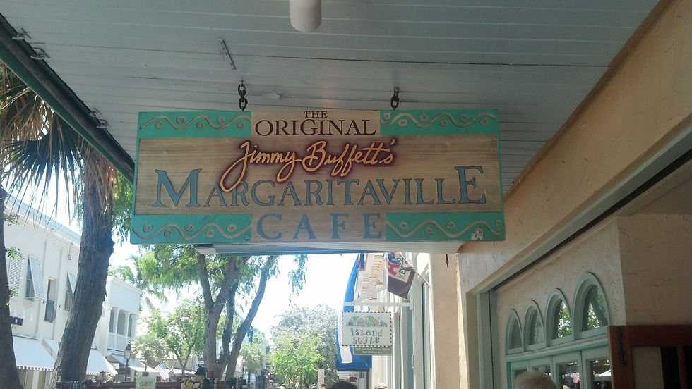
Or maybe I was just "wasting away again in Margaritaville" cafe on Duval St.

Thursday, May 16, 2013
So I skipped a few days of blogging to go along with how life has been lately; very laid back. Even the ride up from Key West was like a pleasant walk in the park -- a park with calm seas, light blue water and classical music playing in the background. Captain Ken got me liking Vivaldi, Mozart, Handel and Beethoven a whole lot more on this trip. I do have to say though, the great composers do have the wide open, serene ocean to enhance the whole experience of listening to their music. Not that it's not good music anyway. The ocean and classical music just go together.
Here in Marathon again, we've kind of made ourselves at home. Monday, the day of our arrival, was unusually humid, at least compared to what I've experienced down here. It was a pleasant change from the windy days we've had though, which actually started right back up the next day. The past three days we've seen wind up to 25 knots again. It's made many of the things we want to do, like diving and snorkeling out on the reefs, a little to risky to venture out.
After about six weeks cruising down the coast, we finally put our bare feet in some beach sand today. There really aren't many beaches in the Florida Keys, believe it or not, but there is one on Marathon just at the end of Sister Creek. After taking the dinghy down the creek we dragged it up onto the beach, worked on getting rid of all our strange tan lines, and then took a dip in the cool water. On the ride back we explored some of the quieter creeks off Sister Creek. The mangroves all around us made it easy to pretend we were deep in the Amazon or Congo.
We then spent the evening at the tiki hut in the Marathon marina. After having some pizza, we talked with some locals who are also living on their boats. Perpetual travelers, nomadic sailors, rambling spirits, they were the kind of people you felt like you knew your whole life. They gave us some fresh sweet corn, and homemade chocolate chip and pistachio cake, while we listened to Sublime, Pearl Jam and Bob Marley in the tiki hut. Then we rode back to the boat in the dinghy in the dark of night with boat anchor lights guiding the way and the wind at our backs.
Sunday, May 19, 2013
Pentecost Sunday I went to San Pablo Church and took some pictures. It was the pastor's last day, so the church was filled with jovial farewells and much gratitude for the priest's 19 years of service to the parish. The farewell was fitting since it was also my last day in the Florida Keys.


Monday, May 20, 2013
Well, we left Marathon at 6:15 a.m. and arrived at Virginia Key just off the coast of Miami 12 hours later. The 112 mile trek shattered our former record of 90 miles in one day.
So farewell, Florida Keys. A month of good times with you will not be forgotten.

Hawk Channel seemed to live up to its reputation with big waves for about half the ride up to Miami. We passed through a storm around Rodriguez Key, and thought about anchoring there for the night, but the weather soon after cleared up so we pushed on.
So our journey home has officially begun. Many of the sites we saw on the way down will be revisited with more attention.
Thursday, May 23, 2013
We've traveled so much the past few days that it's tough to remember many details. As we passed through the Golden Coast of Florida, with cities that have as many canals as streets, we saw many multi-million dollar mansions that didn't cease to impress us even when we remembered seeing the same ones on the way down.
One extra thing we did notice though was that many of the mansions seemed empty. They were well-kept with manicured lawns, well-maintained pools and all around pristine grounds; but not one mansion had a single person lounging in the backyard, or doing some yard work. The lack of life in these supreme edifices was perplexing, and I soon began to realize that the lifelessness kind of symbolized how lonely it must be to be rich.
Trolling along the waterway with these mansions on either side, we also continued to see many mega yachts with names like "Sexy" and "Cool Cat". But all of this excessive wealth didn't make us blind to the fewer, and therefore more cherished, wonders of nature that came in sight. Near Ft. Lauderdale we saw a large creature swimming quickly past us. It was too fast to be a manatee, and it didn't come up for air so it couldn't have been a porpoise. We concluded that it thus must have been an alligator, and said nothing more about it. So that's how the story will remain. No one else saw what we saw. Not to say seeing an alligator is even that much of a novelty in this area, but it was the first time we "saw" one on this trip, so don't ruin the experience for us by saying it might not have been an alligator.
So we left Virginia Key Tuesday and traveled to Boca Raton, which is really only about 45 miles, but after factoring in all of the no wake zones and bridges we needed opened, the trip wound up taking about 8 hours. The next day we traveled much further, starting in Boca Raton and anchoring out near the bridge at Jensen Beach.
The first part of the day was slow going because there were still many low bridges that needed opening. We tried our best to time them just right, figuring if a bridge opens on the hour and half hour and is about 10 miles away, and it's now 10 a.m., we should slow our speed to about 5 knots to get there without having to sit in idle speed for the next opening. Then there was always the risk of getting there too late, and having to wait even longer for the next opening. At times I would have preferred the choppy Hawk Channel, with the seasickness and all, over lethargically moving through these tedious ICW passages of Southern Florida.
The Southern Coast has the Palm Beach cities, which I found to be architecturally authentic and pleasing to pass on the water. The downtown's buildings had a sort of neo-art deco look to them, but they also had the bright colors of the Florida landscape rather than the earth tone colors of older northern art deco buildings.

After another early start and long day, today we are staying at Titusville City Marina. It's the first time we've been hooked up to shore power since our stop in Jacksonville on the way down about five weeks ago. In case you were wondering why this post is unusually long, having shore power means we have all the electricity we can possibly need on a boat, and we don't have to run on the generator when we want Internet access. One of the best parts of this trip is having simple conveniences and pleasures become like luxuries. After checking into the Marina we walked down the road to get KFC for dinner. I'm not a big fan of fast food, but when you only have it after traveling on the sea all week, and then you have to walk a mile from the marina to get it, the fried food and free refills become less of an indulgence, and more like a reward for surviving so many days without the creature comforts so many Americans often take for granted.
Friday, May 24, 2013
On this trip down and up the coast, I didn't see many of the things I expected to see, but I'm also seeing many things I didn't expect to see. I didn't see little remote cays in the Bahamas with sandy beaches, but so what. I did see a Titan submarine near the Florida-Georgia line, I saw the sun rise over the Atlantic and set over the Gulf of Mexico in the same day, and today, to add to the list of unexpected sights, we saw a Delta 4 rocket take off at Cape Canaveral.
I apologize if that seemed to come a little out of the blue. I failed to mention in my post yesterday that Titusville is just across the Indian River from Cape Canaveral. Many of you might have known that already, but to me the many cities along Florida's east coast just form one major urban conglomeration, so I only knew of Cape Canaveral, and was oblivious to what cities were nearby.
We knew about the launch yesterday, which was when it was originally scheduled, but it was postponed to today due to stormy weather. Yesterday's storm was, by the way, quite a storm by my reckoning, quite a show in itself. But when we didn't know the launch would be rescheduled for today we were kind of disappointed to hear of the postponement, because we thought we would miss the launch altogether. "How hard can it be", Captain Ken said, "to conduct a launch in a thunderstorm? It's not like it's rocket science."
After the storm, God's promise appeared in the sky and never do I think I saw such a strongly defined rainbow. If a pot of gold could be found at the end of rainbows, I might have been convinced to go journey to the end of this one since its bottom was so clear to see from where I stood.

Then, after a boisterous night with trains passing through Titusville every few hours, we spent some hours getting provisions at Publix, and then adjusting the lines on the boat to keep it from hitting the wooden sidings on the dock. Afterwards, we were ready to see the launch.
We took a walk to the bridge where we could get the best view. There were people all around, even some people partying at a live concert at the foot of the bridge. A beautiful sunset on the side opposite of Cape Canaveral, and a full moon right above the base, added to the ethereal atmosphere of the whole celestial show tonight.


So we cruised the waterway expecting to experience the adventures and thrills of life on the sea, and here we are watching rockets take off into the sky. So goes life. You expect one thing and it doesn't happen, but the things that do happen wind up being even more phenomenal, coincidental and serendipitous. What are the odds that we just happened to be in Titusville the night of a launch? The timing for us was very providential, but perhaps just as provident, and appropriate, was the fact that this Delta rocket kicked off, or I should say launched off, Memorial Day weekend. What better way to salute our veterans than by watching a massive piece of American ingenuity light up the sky? Not to mention, the rocket was bringing into space a military satellite, and one for Boeing.

Monday, May 27, 2013
Where does one begin when speaking of the city that began before any other European settlement in the United States? St. Augustine can’t be summed up in a blog post, and despite its relatively small size it’s still tough to see all of its landmarks in two days. Nevertheless, I tried.
The St. Augustine Cathedral Basilica is in the northwest corner of the city’s main plaza and the first parish established in the United States. Spanish missionaries began missions in Florida 100 years before those in the West. St. Augustine Cathedral could be considered the archetype of Spanish Mission architecture, with its adobe walls, surrounding plazas and smooth arching shapes. It’s remarkable to see an architectural style common in the West within an East Coast city.

Unlike many basilicas that are awe-inspiring with their celestial domes and elaborate grounds, the authenticity of St. Augustine Basilica is in its intimacy. As soon as you enter, the low ceilings remind you that you're in a church that was built in an outpost of the Spanish Empire, not some booming capital city. The dim lighting makes you feel like you've been transported to a time when the only interior light came from windows, candles and oil lamps.

Just down the road from the basilica is Flagler College, with spires rising up more distinctly than any other building in the city. The great entrepreneur and philanthropist, Henry Flagler, built the structure, which was originally the Ponce de Leon Hotel. Flagler, the founder of Standard Oil and the Florida railroad made many other large contributions to the city, but when it came to sharing his business success in the city, he wasn't as generous. Rumor has it that Frank Smith, a Boston millionaire, had ambitions to build a hotel right by Flagler's, but Smith couldn't get all the materials he needed down to St. Augustine without using Flagler's railroad, and Flagler would have none of that. He closed the railway to the train bringing down Smith's furnishings for the hotel. Naturally Smith's establishment didn't succeed.


The fort was built by the Spanish in 1696 as a stronghold to guard their ships, which traveled up the Florida coast from the Caribbean and used the Gulf Stream to get back to Spain. The strategic location of St. Augustine was coveted by the French and English, but Castillo de Marcos successfully defended every attack from these enemies, even after the city burned down in 1702. But as long as the fort stood the Spanish were able to maintain control of the settlement.
St. George Street is a pedestrian only street lined with stores and restaurants, and it was packed with tourists passing through the historic city or locals enjoying a day trip on Memorial Day.

As I continued to intentionally wander and take in as much of the city as possible, a majestic dome peered out above the palm trees in the corner of my eye. It was the dome of the Flagler Memorial Presbyterian Church. Built by Henry Flagler in memory of his daughter who died tragically, the church is the only Presbyterian church I’ve seen built in the Venetian Renaissance revival architecture style. As I passed and took pictures, I heard someone say that this was the city's basilica, basing their comment on the fact that they heard the city had a basilica. Err, wrong. The basilica is right in the middle of the city, just north of the main plaza. They wouldn't tuck a basilica behind the campus library, for goodness sake!
Although, I was a bit jealous in noticing that the Presbyterians might just have a more beautiful church than Catholics in one of the most historically Catholic cities in the U.S. But they had a millionaire philanthropist build theirs, so that's not fair. No hard feelings though. I celebrate all beautiful churches simply because they glorify God. Going back to our ignorant tourists, as they passed by the church they said nothing more about it except "It's very old".

One of my favorite sites in my St. Augustine wanderings was a locale that wouldn't be worth much at all to anyone else, but I must include it anyway in my snapshot of the city. As I was looking for a place to buy milk, I wandered off the beaten path a little and found myself strolling down this side street that most accurately depicts the humble Americana culture of the south.

This street was maybe two blocks from the city's renowned historic section. Here's to intentionally wandering and coming across things you didn't expect.
Wednesday, May 29, 2013
Yesterday we traveled from St. Augustine to Cumberland Island, about 68 miles. Cumberland Island is a 17-mile long nationally preserved barrier island in Georgia right on the Florida-Georgia line. I spoke of its historic significance in an earlier post, but didn't provide many pictures of the wild horses that roam the island. Today we wandered through the national park's north end, and got to see all of the wild horses we could ask for. Most of them were hanging out on the Dungeness mansion's grand lawn, because it's probably the best opportunity for grazing on the island.


Some were also hanging out by the water near the Dungeness dock, like this filly and her mother.


We walked about a half-mile to the beach, and saw this surreal tree to our left from the wooden walkway.The only way it could have been more peculiar is if it extended its limbs out to the walkway to grab us.


The Dungeness mansion was the home to Andrew Carnegie's sister-in-law, Lucy Carnegie. She and her family left the island in 1925, and the mansion burnt down about 30 years later, alleged to be arson.
There were also turkeys, deer, and curious little fiddler crabs that we saw on the island. It is a very enjoyable place to explore. Trails guide the way to sand dunes and the beach, and there are a few dinghy docks providing easy access to the island for transient boaters like us.
We got to Cumberland Island early since we left St. Augustine at sunrise yesterday. It was a good thing we did arrive early because the tricky 8-foot tidal range had us looking all around the northwest side of the island for a good anchorage. Getting up early for its own sake also has its own perks though, like this sunrise over St. Augustine yesterday.

So I'll end today's post with a picture from the beginning of yesterday. Seems appropriate in a backwards sort of way. Tomorrow we head for Umbrella Creek just off Jekyll Sound. It's only about 22 miles away, but we can use a short day of travel.
Friday, May 31, 2013
The waters along the Georgia coast are blessed with dolphins, but infested with swamp flies. As we crossed Cumberland Sound after leaving Cumberland Island, the waterway became narrow and meandered like a sidewinder snake through the Georgia marshes -- making the waters calm enough for the dolphins to play but also stagnant enough for the flies to pester us.
There is no sane geometry to the course taken by the network of rivers that form this part of the waterway. Sometimes we could be hundreds of yards in front of a boat and see it heading towards us along the river bend we just passed. These rivers connect yet another network of wide sounds that were luckily relatively calm today. As we zig zaged through these waters today, many dolphins played along our bow and in our wake -- often jumping high out of the water. We saw many dolphins in this area on the way down as well, but this time around they seemed more comfortable around us -- as if they remembered the last time we passed through and saw no need for caution.
I know we said we would anchor in the same places we anchored at on the way down, but after stopping in Cumberland Island we decided we could go further than Umbrella Creek off Jekyll Sound. So yesterday we stopped in New Teakettle Creek instead, about 50 miles further north. Subsequently, today, when we came to the place we anchored on the way down, Vernon View, we decided we can once again go much further and wound up another 25 miles north on the New River just past the Georgia-South Carolina line.
So we're back in the state we began. This actually didn't even occur to us until we had settled in for the day. After observing the guide and charts closely, we noticed that the Savannah River was the border between the states, something unbeknownst to us as we crossed the river.
On the way down, the area we traversed today was the most treacherous probably along the whole trip, with various wide and windy sounds, and the infamous Florida Passage and Hell Gate. Today the waters had no chop though, and we passed the narrow passages mentioned in high tide. We sort of subconsciously employed a different technique too. On the way down, since it was our first time passing through the area, we payed extra attention to Hell Gate and were consequently petrified when all the dangerous portents we heard about the place turned out to be true. This time around we approached the area with much more leisure, in fact we came to the passage a bit unexpectedly, and ironically passed through it with no trouble at all.
Perhaps a good lesson in life could be learned from these experiences on the waterway: Life takes no patterned course. It's full of twists and turns like the rivers along the Georgia coast. And there's no reason to worry about what's ahead because, as Tom Petty said "Most things I worry about never happen anyway."
Sunday, June 2, 2013
I'm sure Charleston is a wonderful city; in fact it has been voted the number one U.S. city, whatever that means. Forgive me though, for I must dwell on the city's shortcomings for two reasons. Number one, we didn't have the privilege of debarking in Charleston on this voyage, so to find some contentment in just passing by the Holy City, I've decided to pretend it's not a very marvelous city at all. And I'm sure it's not. Number two, the harbor is treacherous beyond reason. We planned on anchoring there today, but competitive winds swung us all around the designated anchorage across from the marina and almost pushed us into surrounding boats. After struggling to get the anchor up and find a more favorable spot, we decided to leave Charleston altogether. Alas, on our voyage down the coast, as we left Charleston after staying in the marina for the night, I felt a nostalgia come over me in bidding farewell to the Southern gem. I remember Edwin McCain's song ringing in my head, "In the Holy City, I heard the spirits in the steeple singing 'You'll be back again.'" And for sure I thought we would be back, and see more than the city marina. I thought we'd see the churches and carriages, the Southern architecture that comes into its own in that cherished setting. But it was not so. Charleston Harbor blocked the city from us like St. Peter guards the gate of heaven from those who haven't finished their purgation.
But I haven't stayed true to my promise. Charleston is after all a wretched city. It is no good for a northerner like me. Its residents would probably see me as a nuisance, and all the parks and churches would all be closed to me. There is nothing in Charleston for me to see. So on we went from that wretched place (I already forget its name), and afterwards headed northward along South Carolina's calm, straight and very pleasant portion of the ICW. When I was steering the boat along these stretches, I barely had to touch the wheel. Avalon stayed her course from marker to marker with the help of the gentle current.
I haven't spoken much about the every day routine Captain Ken and I have on the boat. It's quite simple actually. When we're on the move, we get up early -- often around 6 a.m. -- pull up the anchor if we're anchored, untie the mooring if we're tied to one, or untie from the dock if we're at a marina. Then we take turns driving while the other either navigates or relaxes. Most days are much more pleasant than stressful, but every now and then we have trouble with the anchor or run into inclement weather. Then, after reading the GPS, charts and guide, we decide the best place to stop for the night. We usually anchor out since it's free. Today, for instance, we anchored in a place called Awandaw Creek just south of McClelanville, SC. There's a small town in the distance to the south called Andersonville, but other than that the spot is surrounded by wide vistas of Southern marshes. We can see forever. Tomorrow we plan to get up early and see if we can get to Barefoot Marina, North Myrtle Beach, where we began our trip. It's about 80 miles away now. Today we traveled 80 miles from Upper Rock Creek.
Monday, June 3, 2013
Last evening a rusty, rugged little boat called Dynasty came up Awendaw Creek where we were anchored. The crew of five seemed to come out of the distant unknown yonder since the water and marshes stretched as far as the eye could see all around us. These visitors passed our boat with a wave as if in a dream, and thus began the last 24 hours of our voyage.
After pulling up the anchor at about 6:20 a.m., we were soon met by rain that followed us on and off well into the afternoon. Thunder and lightning came too close for comfort at times, but other than that the rain was welcome because it gave the boat a good rinse down and kept those exasperating swamp flies away.
Through the course of this voyage, we traveled over 1650 miles through swamps, sounds, ocean, rivers and channels. We went through seaside metropolises, empires of marsh, jungles of mangroves, and neighborhoods of mansions fit for royalty; but I believe my favorite part of the Intracoastal Waterway is just a few miles from where we started. In the central part of South Carolina, the Waccamaw River meanders through the pristine forests of the state's Low Country. Fresh water creeks empty into it from far away places known by few people. We came to the river about midday. I dozed off in the love seat on the sun deck while still in the South Carolina marshes, and when I awoke I found myself surrounded by this endless landscape of graceful trees gently rising from the banks and hanging their branches over the river.

In the middle of this forest we passed the Socastee Bridge, the first bridge we needed opened since central Florida. From there was the home stretch. We passed a dock along the waterway that had a random McDonalds sign on it, and the fact that it made our mouths water was proof that we'd been away from civilization for too long. We passed the Grand Dunes and all its wealthy homes one last time, and recalled how the development was the end point of our five-mile test runs before starting the long haul down the coast.
We tied up to Barefoot Marina around 4:30 p.m. and shed all our worries of going aground in shallow water, capsizing on the open ocean, crashing into other boats or becoming stranded in the middle of a wide open sound. We survived without having to endure any serious turmoil. We were a bit shaken by the waves, and maybe a little less accustomed to the ways of civilized man, but we've also seen much proof of other mariners who fared much worse. Like this poor guy.


To those who have followed this blog, thank you. You journeyed with us the whole way. I hope you shared each moment with enjoyment. We plan to spend the next few days tidying up the boat, and then we'll drive up to New Jersey, which will always be home sweet home.
Comments